 icons on the map to see the photos of the places.
by D. N. Rassokhin (aka Dima)
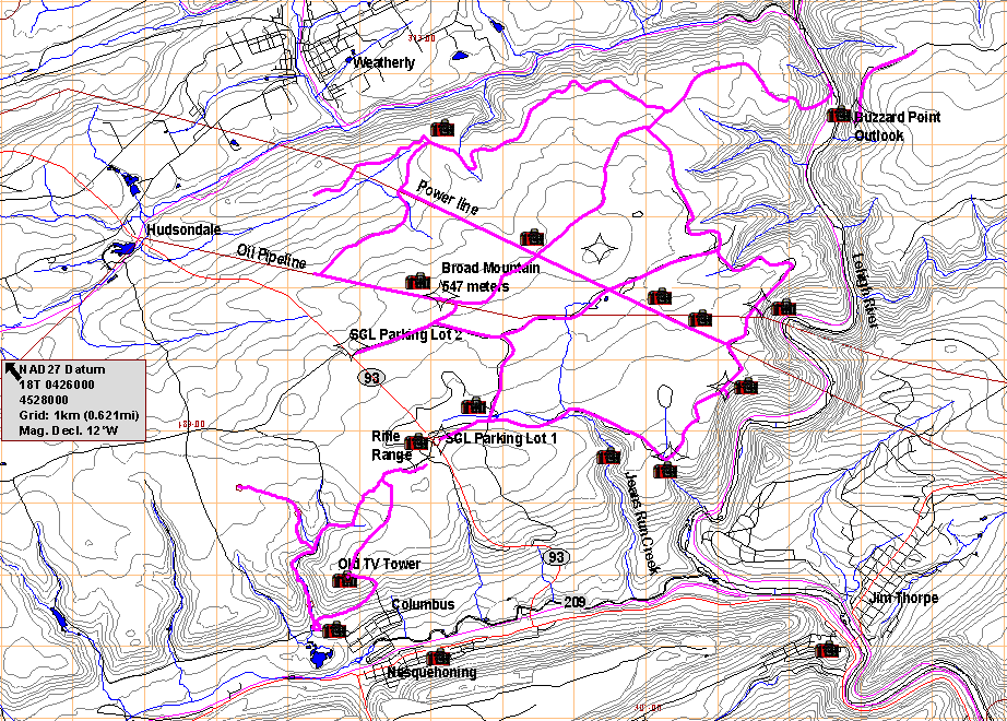
The pink lines on the map are the trails I recorded with my Garmin 12 Global Positioning System receiver while mountain biking, hiking and watching wild animals with my dog Alisa in the Lehigh Gorge area of the Pocono mountains NW of Jim Thorpe.
Click on the camera
icons on the map to see the photos of the places.
Map is still in the works, and more pictures are coming, so check again soon.
The map uses the Universal Transverse Mercator grid with NAD27 datum. Microsoft Internet Explorer or Safari (Mac OS X) users: move the mouse pointer over the map to the point of interest and read its coordinates in the window status line. The position estimation accuracy is approximately +-100 meters.
GPS users: set the map datum to NAD27 CONE and position format to UTM/UPS (Garmin 12 devices have these settings accessible via the Setup Menu/Navigation).
Author: D. N. Rassokhin. Last updated: Sun Jul 27 15:51:38 EDT 2003 @869 /Internet Time/
Please send comments to Dima.